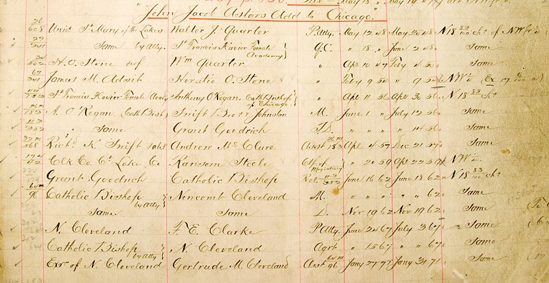
| The detail on the right, from the page of a Chicago Title and Trust Company Ante-fire tract book, lists the 1849 acquisition of a warranty deed for part of the grounds of the Catholic Cemetery. This parcel of land covers the area between Burton Place and Schiller Street, and from Dearborn Street to today's State Street. Chicago's first Catholic Bishop, the Right Reverend William J. Quarter originally acquired the land that he left in his last will and testament to the Sisters of Mercy, who established the University of St. Mary of the Lakes, Chicago's first school of higher education. It does not appear that the university ever occupied these grounds. The early university campus was located between Wabash Avenue and State Street, and Chicago Avenue, south to Superior Street. Bishop J.O. Van de Velde acquired the Sisters' land, and extended the cemetery into these grounds. |  By courtesy of the Chicago Title and Trust Company. |
|
||||||
 |
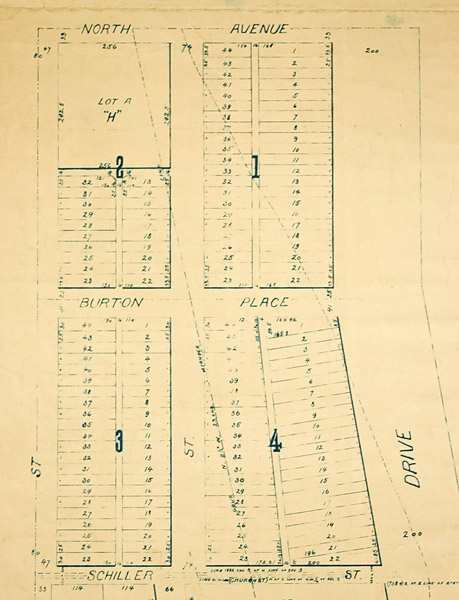
 By permission and courtesy of the Chicago Park District Special Collections. |
|
||||||
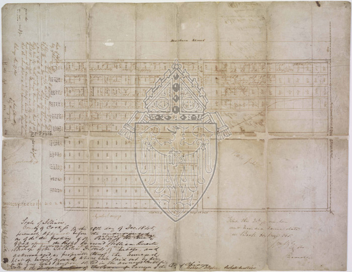
In 1845, the first land subdivision was conducted of the area that would become the Catholic Cemetery. Bishop William Quarter annexed a parcel of land from William B. Ogden. who owned land west of today's State Street. The Catholic Archdiocese in Chicago has that original plat of this earliest section of the cemetery in its Archives. I was able to photograph a copy of the plat for my personal research purposes, but I was not allowed to publish those images on this Web Site. See a complete description of that map, here. The first subdivided section of the Catholic Cemetery covered the area from Dearborn Street, east to what would become State Street, and from North Avenue, south to Burton Place. In several subsequent land acquisitions, the cemetery extended south and east to include the entire area from North Avenue, south to Schiller Street, and from Dearborn Street, east to the lakeshore, approximately today's Astor Street. Pamela Bannos © 2008 |
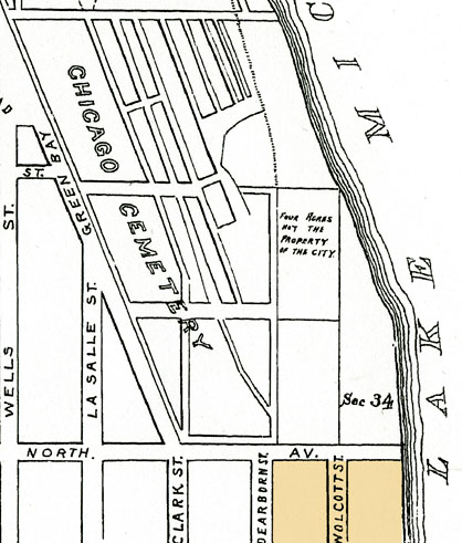
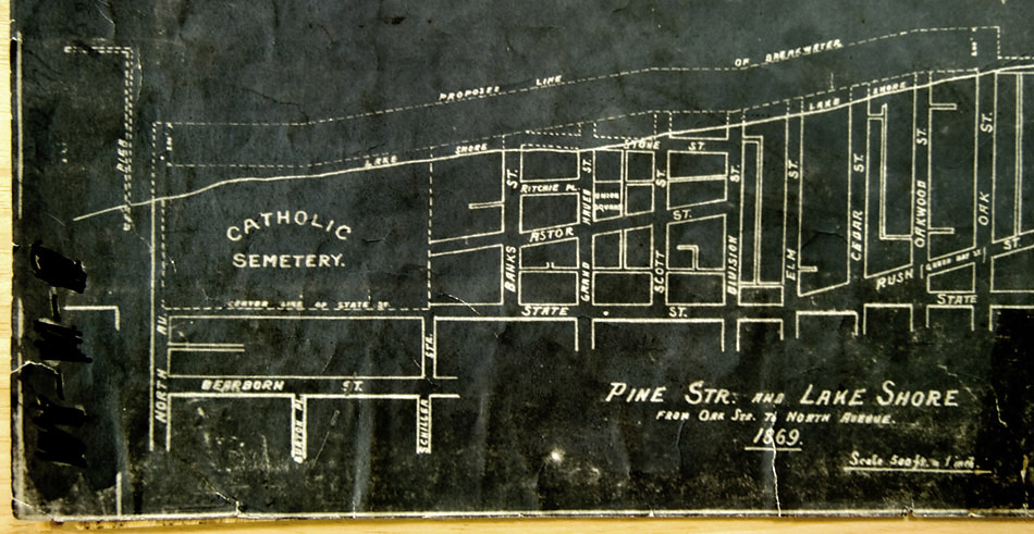
It is unclear to me why the 1869-dated map, above, shows the Catholic Cemetery as only occupying grounds east of State Street. Some later maps continue to show Dearborn Street as the western border. The earliest surveyed portion of the cemetery occupied the grounds from Dearborn Street east to today's State Street. The Eastern direction is at the top of this map. The cemetery's earliest potter's field occupied the grounds in the northeast quadrant of the land between North Avenue and Burton Place. It is possible that graves in this area were removed to the new Calvary Cemetery beginning in 1860 at its opening. As with the City Cemetery, interments continued until 1866. Clearly all graves were not removed, as I came across two specific references of unexpected findings between Dearborn and State Streets, north of Schiller Street, during construction projects in 1947 and 2004. Hearsay and off-the-record conversations also suggest forgotten graves. See a map detailing unexpected findings in the area of the Catholic Cemetery, here. |
By the time the map pictured above was drawn, the lakeshore had advanced outward, extending the Catholic Cemetery's area. The eastern (top) edge of the map, shows city streets extending directly into the lake. Portions of Stone Street are submerged, suggesting the lakeshore also had the tendency to recede. The 1880s era map presented on the right, depicts the entire Catholic Cemetery grounds illustrated above. This map indicates the earlier 1840s lakeshore as following the eastern edge of Astor Street. Beginning in 1869, with the construction of Lake Shore Drive, which connected Oak Street to North Avenue, landfill established the shoreline of Lake Michigan. The Catholic Bishop, who became incorporated in 1861, acquired ownership of the landfill area. He then subdivided the grounds and sold the lots as individual properties. See information about the Catholic Bishop's two lawsuits for riparian rights against the Lincoln Park Commissioners, here. See information about the developing Gold Coast, here. |
||||||