 Courtesy of the Chicago Title and Trust Company. |
||||
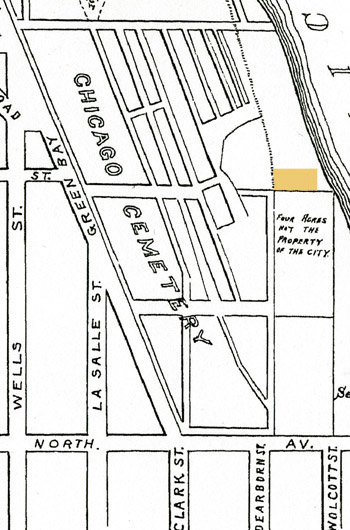
The 1846 acquisition of the Jewish Cemetery tract was never officially recorded in the city's record books. In 1855, when members of the Kehilath Anshe Mayriv congregation realized they had misplaced the deed, they approached city officials, seeking a new one. After submitting an affadavit claiming payment and ownership, the grounds were re-surveyed, and the congregation was issued a new deed. See the affadavit, here. Presented above, is a detail from a Chicago Title and Trust Ante-fire tract book listing the congregation's new deed acquisition, its recording date, and the survey language describing the 9/10-acre location on the northeast edge of the City Cemetery property. The line above the Jewish Cemetery tract describes the subdivision of the city's newly-acquired grounds that came to be known as the Milliman Tract. In 1846, the Jewish congregation bought the land for $45. In 1882, the Lincoln Park Commissioners acquired the 9/10-acre ground for $8000. See the Jewish Cemetery timeline, here. The City Cemetery map at the right shows a highlighted box where the Jewish Cemetery occupied an area that eventually became situated within the City Cemetery grounds. The area on the map, described as four acres of private ground, was acquired by the city in 1851 and became part of the potter's field. |
 |
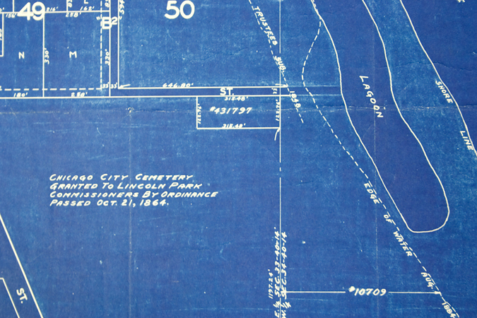 By permission and courtesy of the Chicago Park District Special Collections. This survey map shows the parcel numbers of the various tracts of land that were acquired by the Lincoln Park Commissioners. The dotted line at the right indicates the 1848 lakeshore, showing the Jewish Cemetery, established in 1846, occupying grounds near the water's edge. |
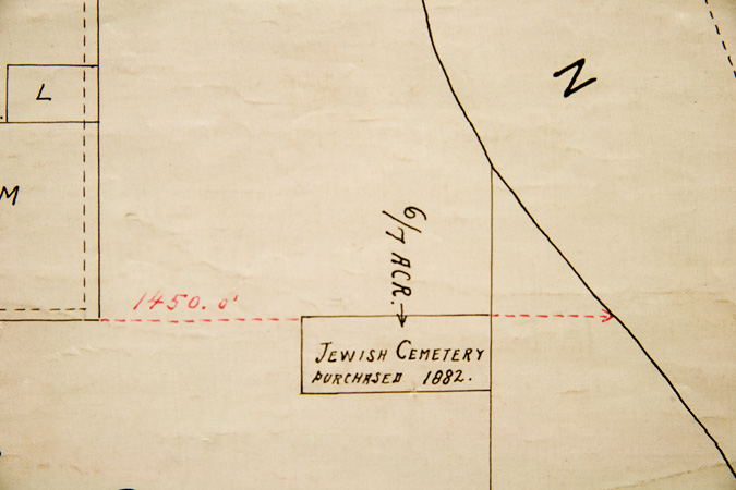 By permission and courtesy of the Chicago Park District Special Collections. This detail of a map from the Chicago Park District Archives, notes the area of the Jewish Cemetery as acquired by the Lincoln Park Commissioners. The area of the cemetery had at some point become inaccurately transcribed as a 6/7-acre parcel. There is no evidence that the originally purchased 9/10ths of an acre was reduced in size. |
|
| Pamela Bannos © 2008 |
||||