 Courtesy of the Chicago Title and Trust Company. |
||
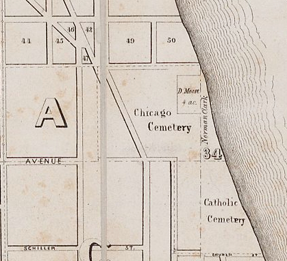
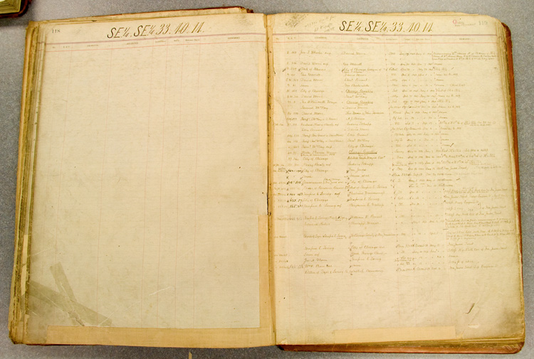
Presented above, is the page in an Ante-Fire tract book containing the exchange and subdivision of land on the grounds now occupied by Lincoln Park, from Menomonee Street, south to North Avenue. The first line, dated, July 27, 1840, records four acres that were acquired by an individual, David Moore, who leased the land to different people until the City bought it from him in 1851. That parcel became part of the City Cemetery potter's field. The third line records the State of Illinois granting the patent for the land to the City of Chicago in December, 1846. The 1849 Rees and Rucker map detail, left, shows the four-acre parcel labeled with David Moore's name. He acquired that acreage before the city paid for the land they were granted in 1837. At that time, the town of Chicago was using two burial grounds, one located at approximately 23rd Street and Wabash, the other at the lakeshore between Chicago Avenue and Oak Street. See the earlier northside cemetery, here. In 1848, intending to extend the burial grounds northward, the city acquired Block 50, and three additional Blocks not visible in this map, extending the grounds to today's Webster Avenue. Unfortunately, Jacob Milliman acquired Blocks 45, 46, 48, and 49 earlier that year. Milliman died less than a year after he acquired his land, and the city bought Block 49 in 1850. Thirteen years later it was found that the city had acquired the land illegally, and the saga of the Milliman Tract began, causing the first surge of exhumations from the City Cemetery. |
||
 Courtesy of the Illinois Regional Archives Depository. |
||
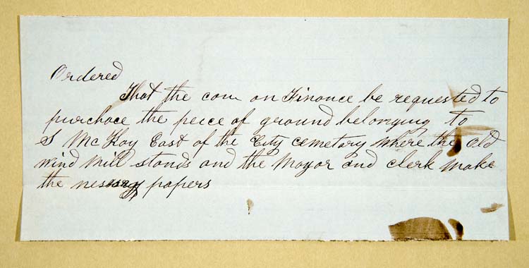
This scrap of paper from the Common Council files, is the order to buy the 4-acre parcel that was then owned by Samuel McKay. The October 13, 1851 document shows that a windmill stood on those grounds until the city acquired the land. |
||
LOTS IN EACH SURVEYOld Survey, last deed No. 806 Vault Surveys, lettered and numbered, 11/1851 – 11/1857 New Survey until Milliman tract, 3/1851 - 8/1852 Milliman Tract, part of New Survey, 8/1852 – 5/1858 Block 1, 3/1854 – 9/1856 Block 2, 12/1854 - 5/1859 Green’s Survey, 12/1857 – 5/1859 ________________________________ Totals Lots: (minimum) |
||
| Pamela Bannos © 2008 |
||