|
Scroll D O W N | | | V V |
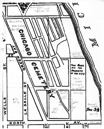
In attempting to visualize the layout of the Chicago City Cemetery, I studied the language of the individual surveys that subdivided the grounds into sections for burial lots. An original subdivision of the Catholic Cemetery which covered the area of North Avenue, south to Burton Place, and Dearborn Street west to what would become State Street, can be seen here. The City Cemetery was filled with graves starting at its southern edge, representing where North Avenue would one day continue through to the lake front. Burials continued north along the city's acreage. As space in each subdivided area was sold, a new section was divided and that land became available for sale as family burial lots. The first interments began in the early months of 1843. The last burial lots were sold on May 1, 1859. The final interments were made in March 1866, after which the ordinance to prohibit further burials was in place. In total, the City Cemetery contained eight sections, including the potter's field. Family burial lot sections, in chronological order, were designated as, the Old Survey, the Vault Survey, the New Survey, the New Survey-Block One, the New Survey-Block Two, and Green's Survey. Surveys named Blocks One through Five were subdivided, but Blocks Four and Five were never filled. Block Three became known as Green's Survey. The Jewish Cemetery had its own subdivided 9/10ths of an acre on land that Chicago's first Jewish congregation bought from the City in 1846. The picture on the right, used on the overlay image on the homepage of this Web Site, is from the 1863 map of Cemetery Park. That original park ground covered an area of the cemetery that had not yet become occupied, running north to Fullerton Avenue. My pencil notations designate various surveys and measurements which helped me understand the layout of the cemetery grounds. |
 |
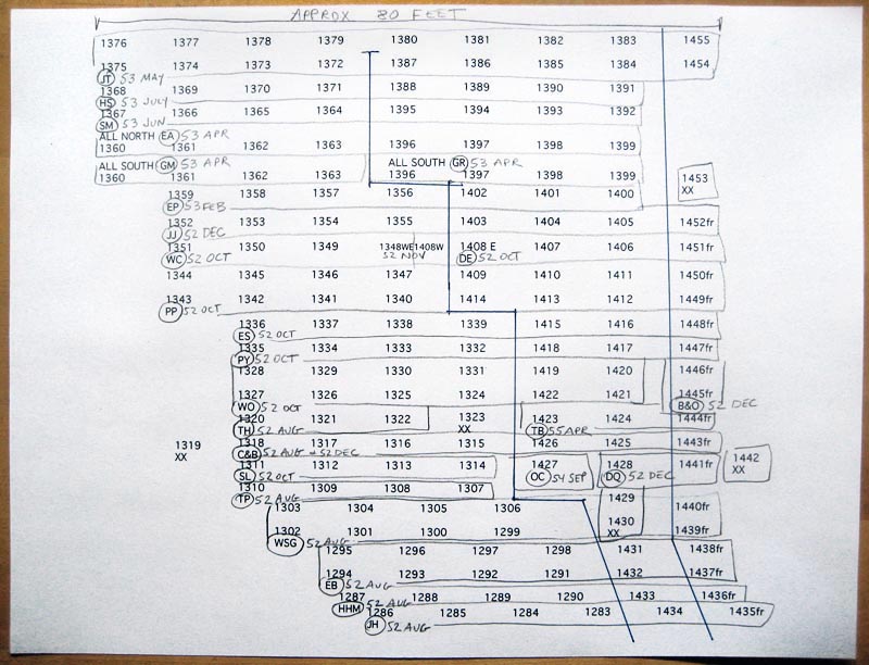
| I was able to create this layout of 172 burial lots within the New Survey. Each number represents a 12 x 9 foot area, making this a diagram that represents an area 600 feet long, running north and south, and 80 feet wide, east to west. This area likely covers the ground from Wisconsin Street south to Menomonee Street, and was a part of the Milliman Tract within the New Survey. Each set of letters represent the initials of the individual who owned that cemetery lot. The dates written in pencil represent the year and month that each set of lots was purchased. In this area of the Milliman Tract, individual purchases often included several lots, creating a large family burial area that was likely set apart with iron fencing or stone coping. |
||
|
||
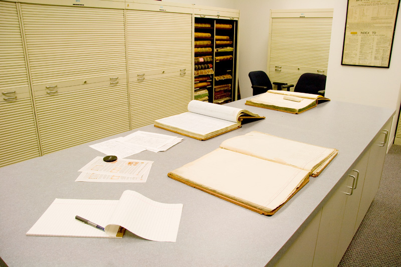
This is the room that holds the Ante-Fire tract books at the Chicago Title and Trust Company. These records list the land transactions that were conducted prior to the 1871 Chicago Fire. Legend has it that a CT&T employee saved these tract books by burying them in sand during the fire. All survey maps were known to have been destroyed by the fire, but three Title companies saved records of land exchanges. These bound documents, under the Burnt Records Act of 1872, became official documents accepted by the courts. The tract books contain the original land exchange records, going back to 1834 for the Catholic Cemetery area, and back to 1840 for the cemetery grounds known as the Southeast Quarter of the Southeast Quarter of Section 33, Township 40, Range 14 (SE 1/4, SE 1/4, 33, 40, 14.) See more about the history of the Chicago Title and Trust Company, here. |
||
 |
||
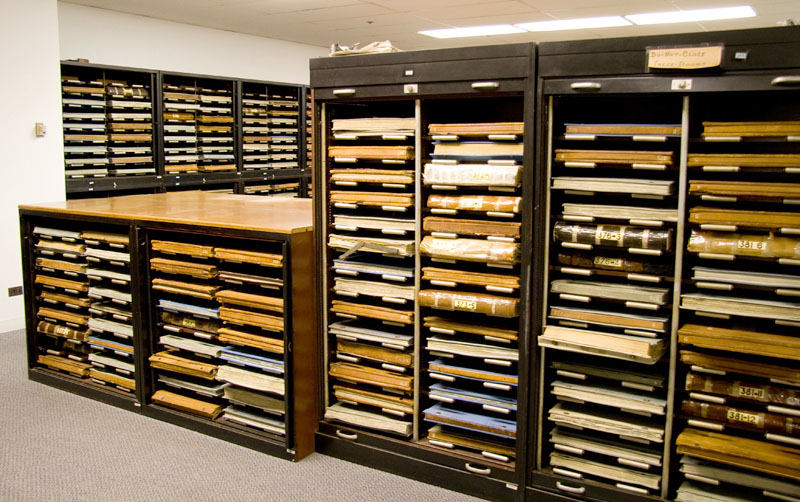
| This is the view from the door of the Ante-Fire tract book room. The Chicago Title and Trust offices contain bound books and atlases representing official land designations and transactions that continue to be used in Chicago real estate transactions. | ||
| Pamela Bannos © 2008 |
||