The Jewish Cemetery

By permission and courtesy of the Chicago Park District Special Collections.

A plat is a map of a parcel of land. The 1856 document on the right describes the area covering the rectagular box above, numbered 431797. That rectangle represents an approximate area of 315 x 122 feet. The dotted line to its right represents the shore line of Lake Michigan in 1848, placing the east edge of the Jewish Cemetery on a sandy beach. This 9/10-acre parcel was originally located on the northeast corner of the Chicago City Cemetery, in an area that was not subdivided until the 1850s.


Regarding the surveyor's language on the document to the right:
One chain is sixty-six feet long. A link is 7.92 inches long. One hundred links make one chain. Ten square chains equal one acre. This measuring system was in use until approximately 1900.

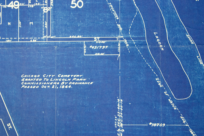
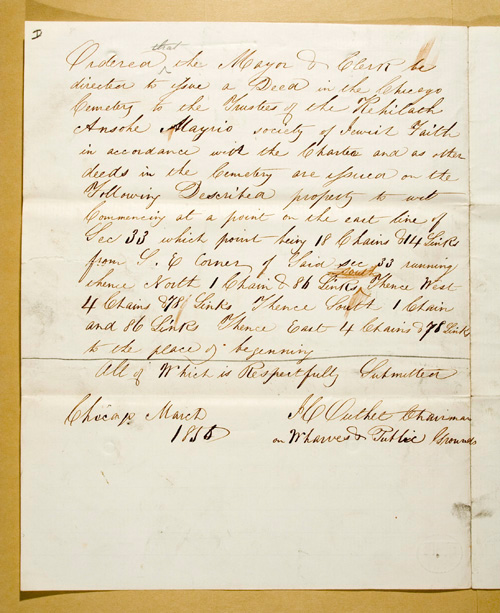
Ordered that the Mayor & Clerk be directed to give a Deed in the Chicago Cemetery to the Trustees of the Kehilath Anshe Mayriv society of Jewish Faith in accordance with the Charter and as other deeds in the Cemetery are issued on the Following Described property to wit
Commencing at a point on the east line of Sec 33 which point being 18 Chains & 14 Links from S.E. Corner of Said sec 33 running thence North 1 Chain & 86 Links Thence West 4 Chains & 78 Links Thence South 1 Chain and 86 Links Thence East 4 Chains & 78 Links to the place of beginning

All of Which is Respectfully Submitted

JC Outhet Chairman
com Wharves & Public Grounds

Chicago March 1856
Pamela Bannos © 2021